Mt. Raung Trekking Adventure
Embark on one of Java’s most challenging treks—Mt. Raung, a towering volcano in East Java with a dramatic caldera and rugged terrain. This 3-day, 2-night trekking program via Sumber Wringin village in Bondowoso offers a thrilling journey through tropical forests, savannas, and steep ridgelines, culminating in breathtaking views from the summit.
About Mt. Raung
Mt. Raung is part of the Ijen mountain range, located in the easternmost region of Java Island. It spans four regencies: Bondowoso, Jember, Situbondo, and Banyuwangi. Known for its vast caldera and extreme trekking conditions, Mt. Raung is considered one of the toughest climbs in Java.
There are two main trekking routes:
- Kalibaru Route (Jember): Leads to the true summit (Puncak Sejati) at 3,332 meters above sea level. Requires technical rope climbing.
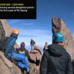
- Sumber Wringin Route (Bondowoso): Leads to Tusuk Gigi Peak, offering stunning views of the caldera without the need for ropes. The final section near the summit is narrow and exposed, requiring caution.
This itinerary follows the Sumber Wringin route, ideal for experienced hikers seeking a non-technical but demanding adventure.
Trekking Itinerary
Day 1: Basecamp to Shelter 1 (Pondok Motor) Start from Sumber Wringin basecamp. The 7 km trail takes about 4 hours on foot or 45 minutes by vehicle. The route passes through farmland and plantations. Vehicle transport is highly recommended.
Shelter 1 to Shelter 2 (Pondok Sumur) A 3-hour trek through mixed terrain with farmland and multiple trail branches. Navigation requires attention.
Shelter 2 to Shelter 3 (Pondok Demit) A 2.5-hour uphill trek through dense tropical forest. Pondok Demit is a wide clearing with no water source.
Shelter 3 to Shelter 4 (Pondok Mayit) A 2-hour trek into savanna and pine forest. This shelter is ideal for overnight camping before the summit attack. No water source available.
Shelter 4 to Shelter 5 (Pondok Angin) and Summit A 1-hour trek through savanna and rocky terrain. The trail passes the memorial of Deden Hidayat, a climber who lost his life here. The final ascent is steep and exposed, with no flat ground. Extreme caution is required.
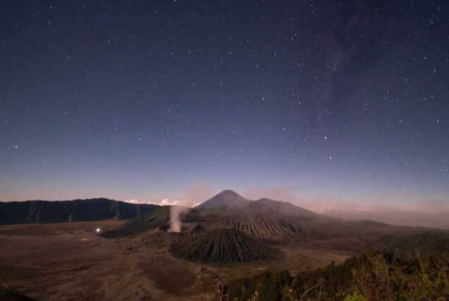
At the summit, enjoy panoramic views of Mt. Raung’s active caldera and crater. You may hear volcanic rumblings even from Shelter 5. The true summit (Puncak Sejati) is visible from here but only accessible via the Kalibaru route with rope climbing.
Descent
The descent takes approximately 6 to 7 hours, depending on stamina and rest stops. You’ll arrive back at basecamp in the afternoon, completing the full trekking experience.
Required Equipment
- Valid health certificate from a doctor
- Trekking shoes with strong grip
- Long-sleeve shirt and warm jacket
- Sleeping bag and mattress
- Headlamp or torch
- Excellent physical condition and stamina